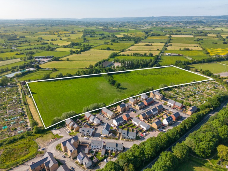
A broadly level greenfield residential development site with the benefit of outline planning permission (Ref.2021/2466/OTS) for up to 90 dwellings. The site is located on the northwest edge of the historic town of Glastonbury & extends to approximately 6.87 hectares (17 acres). It currently comprises of agricultural grass land with an access gate in the northeast corner off Lowerside Lane just off the A39 where the site access is proposed. There is another access gate in the southwest corner off Common Moor Drove. To the southeast of the site are allotments and the recent "Kingsfield" housing development, to the southwest are more allotments and to the northeast is Tor Rugby Club and a funeral directors. There are rhynes (drainage ditches) running along three of the boundaries (not the southwest) which are flanked by vegetation and trees.
Simply fill out the form below or alternatively call us on 020 7839 0888